


NASA's High Resolution Imaging Science Experiment (HiRISE) has captured some extraordinary images of Mars.
HiRISE has already produced several high-resolution images that will allow researchers to study the surface of the red planet in a more comprehensive way than ever before. This time, images of the Danielson crater were sent by the Reconnaissance Orbiter's high-resolution camera, which is of particular interest to space geologists because of the layered sediments.
Although Danielson is not the only place in the Marson, where layered deposits are found, but this is an area where researchers can study extremely well-preserved craters - from a Science Alert. It is also interesting to note that the layers show different levels of erosion: the stronger layers form steps, with layers of weaker material within them.
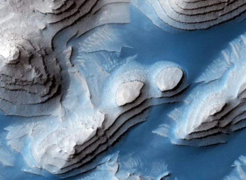
A kőzetek évmilliókkal vagy évmilliárdokkal ezelőtt keletkeztek, amikor laza üledékek telepedtek meg a kráterben, amelyek később megkeményedtek. Egyes hordalékok ellenálóbbak voltak az erózióval szemben, mint mások, ezek később lépcsőfokok formájában emelkedtek ki a talajból. A lépcsőkön a szél később homokot szúrt szét, és az így létrejött zebracsíkos felület jellemzően sötétebbnek és “kékesebbnek” tűnik a képeken.
China's Chu Jung rover on Mars recently found traces of water and wind erosion bukkant on the red planet. Based on images sent back by the Mars rover, the researchers concluded that the Martian land has cohesion that suggests wind erosion, but they also found areas where salt water may have once existed.


 nevű eszköze lőtte a nem mindennapi felvételeket a Marsról. )